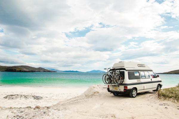
Scotland's Isle of Skye takes its name from the Old Norse word sky-a, meaning 'island of clouds', in reference to the mist that often envelops the Cuillin Hills. It is Scotland's second largest island, with 80 kilometres of velvety moorland, rugged mountains, shimmering lochs and towering cliffs overlooking the sea.
The Cuillin Hills form the most spectacular mountain range in Britain ©Josep Suria
The beauty of the landscapes is the island's main attraction, but there is no shortage of castles, museums dedicated to rural life and cosy restaurants and pubs. There are also dozens of art galleries and craft workshops. Along with Edinburgh and Loch Ness, Skye is one of Scotland's top destinations, but visitors tend to stay in Portree, Dunvegan and Trotternish, so in the island's more remote corners you can always find peace and quiet. Be prepared for widely varying weather conditions: when the weather is good, it is indeed good, but it is unfortunate that it is rare. Here's what to know to best organise your trip to the island.
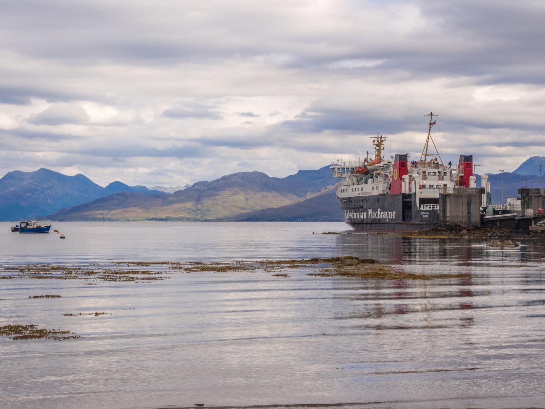
Armadale harbour ©Sue Burton Photography
Armadale and Sleat
If you arrive in Skye by ferry from Mallaig, you disembark at Armadale, at the southern end of a long, flat peninsula called Sleat. The scenery here is not exceptional, but the peninsula provides a magnificent natural viewpoint from which to admire the panorama on the other side; to enjoy the extraordinary views of the Isle of Rum, the Cuillin Hills and Bla Bheinn, follow the steep and winding back road that, describing a wide circle, passes through Tarskavaig and Tokavaig.
Museum of the Isles
Take the road from Armadale Pier toArmadale Castle, a partly ruined castle that was once the home of the MacDonalds of Sleat. Visiting the adjacent museum you will discover all there is to know about the clan and learn about the history of the Lords of the Isles. Among the most interesting exhibits are rare portraits of clan leaders and a wine cup once used by Bonnie Prince Charlie. The entrance ticket also allows you to visit the castle's enchanting gardens.
Recommended guides and products:
Isleornsay
In this pretty harbour, located 13 kilometres north of Armadale, opposite Sandaig Bay on the mainland, naturalist Gavin Maxwell lived and wrote his famous memoirs in The Ring of Shining Waters. In addition to an old hotel and bar, there is an arts and crafts gallery in the town centre.
Visit the Torabhaig Distillery, a converted farmhouse overlooking the sea and home to Skye's second distillery, which opened in 2017. There is a visitor centre and café; we recommend booking tours well in advance.
Elgol (Ealaghol)
On a clear day, the drive along the road from Broadford to Elgol is one of the most spectacular drives on Skye. Along the way you can admire two classic picture-postcard landscapes: that of Bla Bheinn beyond Loch Slapin (near Torrin) and the truly stunning view of the entire Cuillin range from Elgol pier. Elgol itself is a tiny settlement at the end of a long single lane road.
Spar Cave
Just east of Elgol lies Spar Cave, a cave that was visited by Walter Scott in 1814 and later immortalised in his poem The Lord of the Isles. The cave, 80 m deep, is wild and remote and has many fascinating stalagmite concretions. It is located a stone's throw from the village of Glasnakille, but to reach it you have to overcome a series of boulders covered with algae. Also keep in mind that, due to the tides, access to the cave from both sides is only possible for one hour a day. Information on tide times and the route to follow can be obtained from the Elgol tearoom.
Sign up for our newsletter! For you weekly travel tips, special offers, stories from the world and 30% discount on your first order.
The Isle of Skye, or 'Isle of Clouds' ©Stephen Bridger
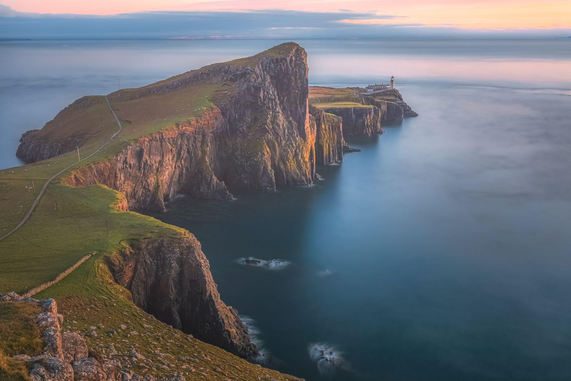
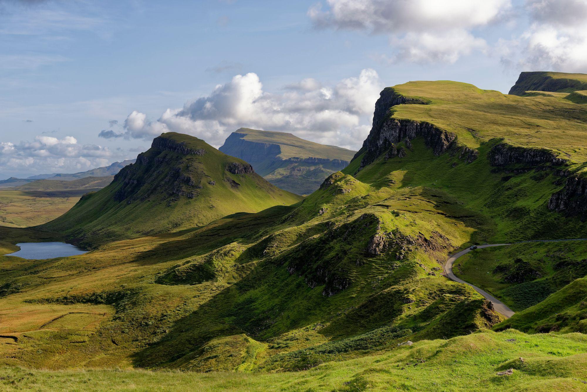
Cuillin Hills
The Cuillin Hills form the most spectacular mountain range in Britain (the name comes from the Norse kjöllen, meaning 'keel-shaped'). Although they are not particularly high (Sgurr Alasdair, the highest peak, barely reaches 993 m), they have an almost Alpine appearance, with sharp ridges, jagged pinnacles, rock-covered gorges and vast expanses of bare rock.
A paradise for experienced mountaineers, the higher sections of these mountains are out of reach for most hikers. However, there are many beautiful low-altitude trails that almost anyone can tackle. There are two main bases in the Cuillin Hills: Sligachan in the north (on the Kyle of Lochalsh-Portree bus route) and Glenbrittle (not served by public transport) in the south.
One of the best trails (on a clear day) climbs quickly from the Glenbrittle campsite to Coire Lagan (9.6 km; at least three hours round trip). The impressive basin is home to a small loch at the top in which you can swim (if you're not chilly), while the surrounding cliffs are an excellent rock-climbing wall (bring binoculars).
Even more spectacular, but also more difficult to reach, is Loch Coruisk (from the Gaelic Coir'Uisg, 'Basin of Water'), a remote loch surrounded by the highest peaks of the Cuillin Hills. Reached by boat trip from Elgol, or on foot along an impassable 8.8 km trail from Kilmarie, Coruisk also became famous thanks to Walter Scott's Lord of the Isles. The writer's footsteps were followed by many Victorian tourists and landscape painters, including William Turner, whose watercolours were later used to illustrate Scott's works.
Minginish
Loch Harport, north of the Cuillin Hills, divides the Minginish Peninsula from the rest of the Isle of Skye. On the south coast is the village of Carbost, home to the Talisker Distillery, which produces the malt whisky of the same name.
The magnificent Talisker Bay, 8 km west of Carbost, is graced by a stacks and a waterfall. The Talisker Distillery produces a sweet, velvety malt whisky with a peaty aftertaste. The guided tour includes a free tasting.
The village of Portree ©BBA Photography
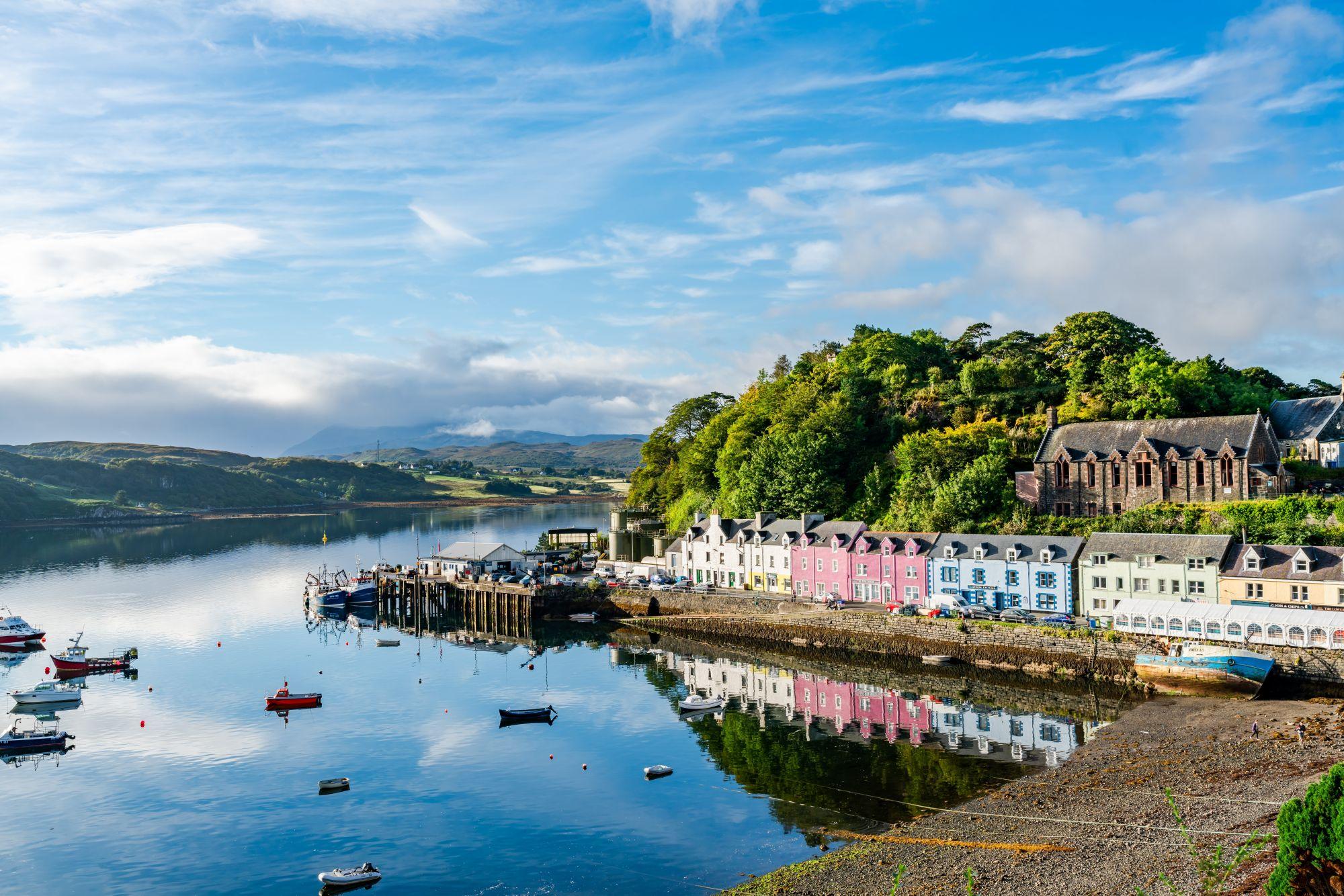
Portree (Port Righ)
Portree is the largest and busiest town on Skye. It has a beautiful harbour lined with brightly coloured houses and offers splendid views of the surrounding fells. Its name (from the Gaelic Portree) was chosen in honour of James V, who went there in 1540 to reconcile the local clans.
Aros Centre
On the southern outskirts of Portree, the Aros Centre is a complex that includes a visitor centre, a book and gift shop, a restaurant, a theatre and a cinema. The St Kilda Exhibition details the history and culture of those remote rocky outcrops, while Xbox technology allows you to take a virtual tour of the islands.
MV Stardust
On the Stardust you can take an hour-and-a-half boat trip into Portree Bay, with possible sightings of seals, porpoises and - if you're lucky - white-tailed sea eagles. Longer excursions (two hours) to the Sound of Raasay and fishing trips are also offered, otherwise you can land on Raasay Island and be picked up later.
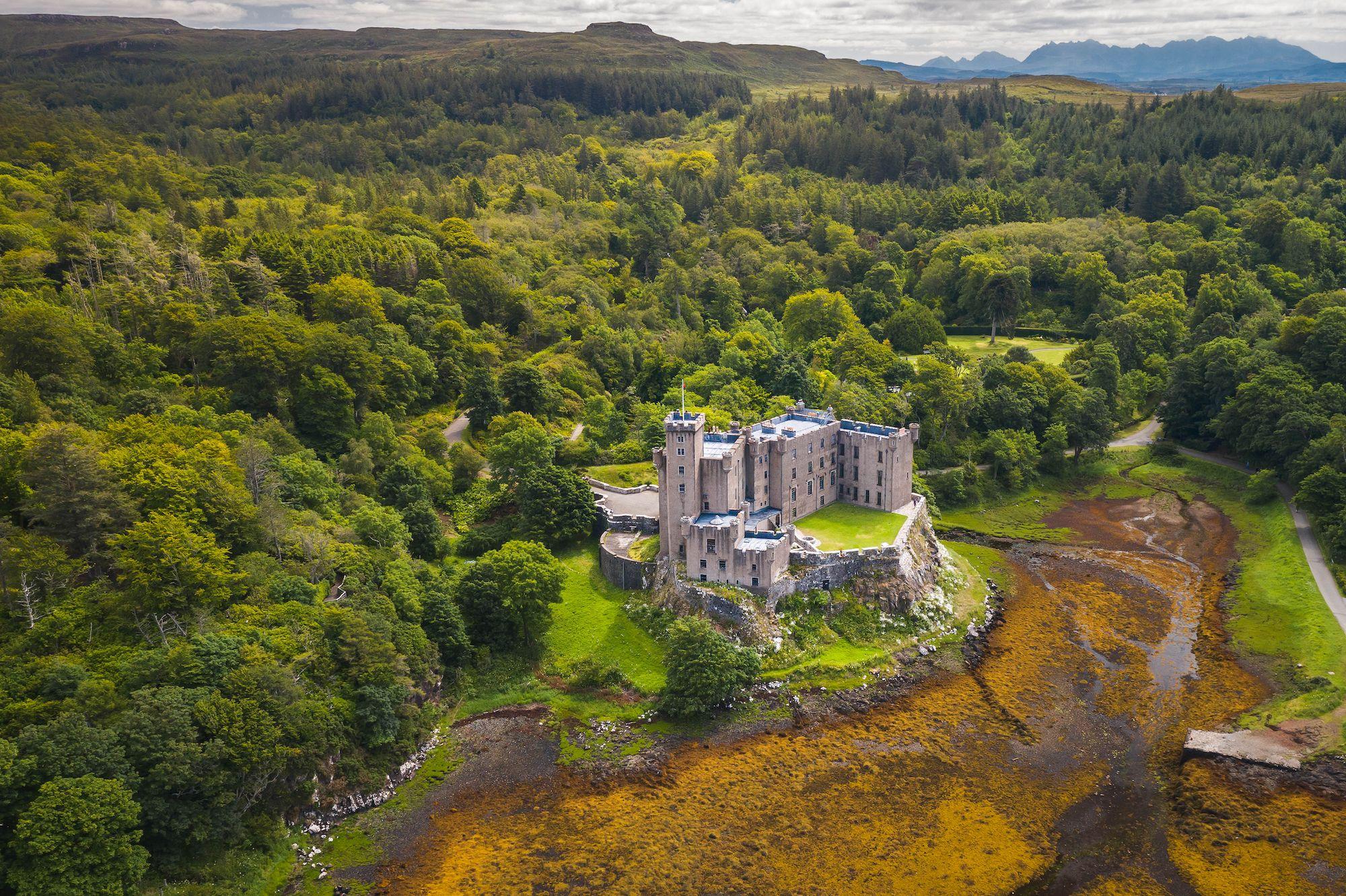
Dunvegan Castle is the most famous building on the island ©Sandro Zahra
Dunvegan (Dun Bheagain)
Skye's most famous historic building and one of its major tourist attractions is Dunvegan Castle, seat of the Mac Leod clan. In addition to the usual castle paraphernalia such as swords, silverware and family portraits, Dunvegan Castle contains a number of interesting artefacts, the most famous of which is the Fairy Flag, a very fine silk banner dating from an unspecified period between the 4th and 7th centuries. Also on display in one room is Bonnie Prince Charlie's waistcoat and a lock of her hair, donated by her granddaughter from Flora MacDonald, a supporter of the Jacobite cause.
From the end of the lane beyond the entrance to Dunvegan Castle, an easy 1.5km path leads to two blindingly white beaches: the Coral Beaches, where the sands are so white because they are formed by exoskeletons of coralline algae called
maerl.
Edinbane Pottery
On the road between Portree and Dunvegan you pass by the Edinbane Pottery, one of the island's craft workshops, founded in 1971; here you can see master potters intent on creating beautiful, brightly coloured pottery.
Read also:
Duirinish and Waternish
The Duirinish Peninsula, west of Dunvegan, and Waternish Peninsula, to the north, are home to some of Skye's most distinctive hotels and restaurants, as well as an eclectic array of artists' studios and craft workshops.
The sparsely inhabited Duirinish Peninsula is dominated by the flat peaks of Helabhal Mhor (469 m) and Helabhal Bheag (488 m), called MacLeod's Tables by the locals. From Orbost, there are a number of beautiful hiking trails, including the one to the summit of Helabhal Bheag (three and a half hours round trip) and the 8 km trail from Orbost to MacLeod's Maidens, a series of pointed stacks at the southern end of the peninsula.
It is well worth the long drive from Dunvegan to the west coast of the Duirinish Peninsula to admire the spectacular cliffs of Waterstein Head and walk down to the lighthouse at Neist Point, from where there is a fine view of the Outer Hebrides.
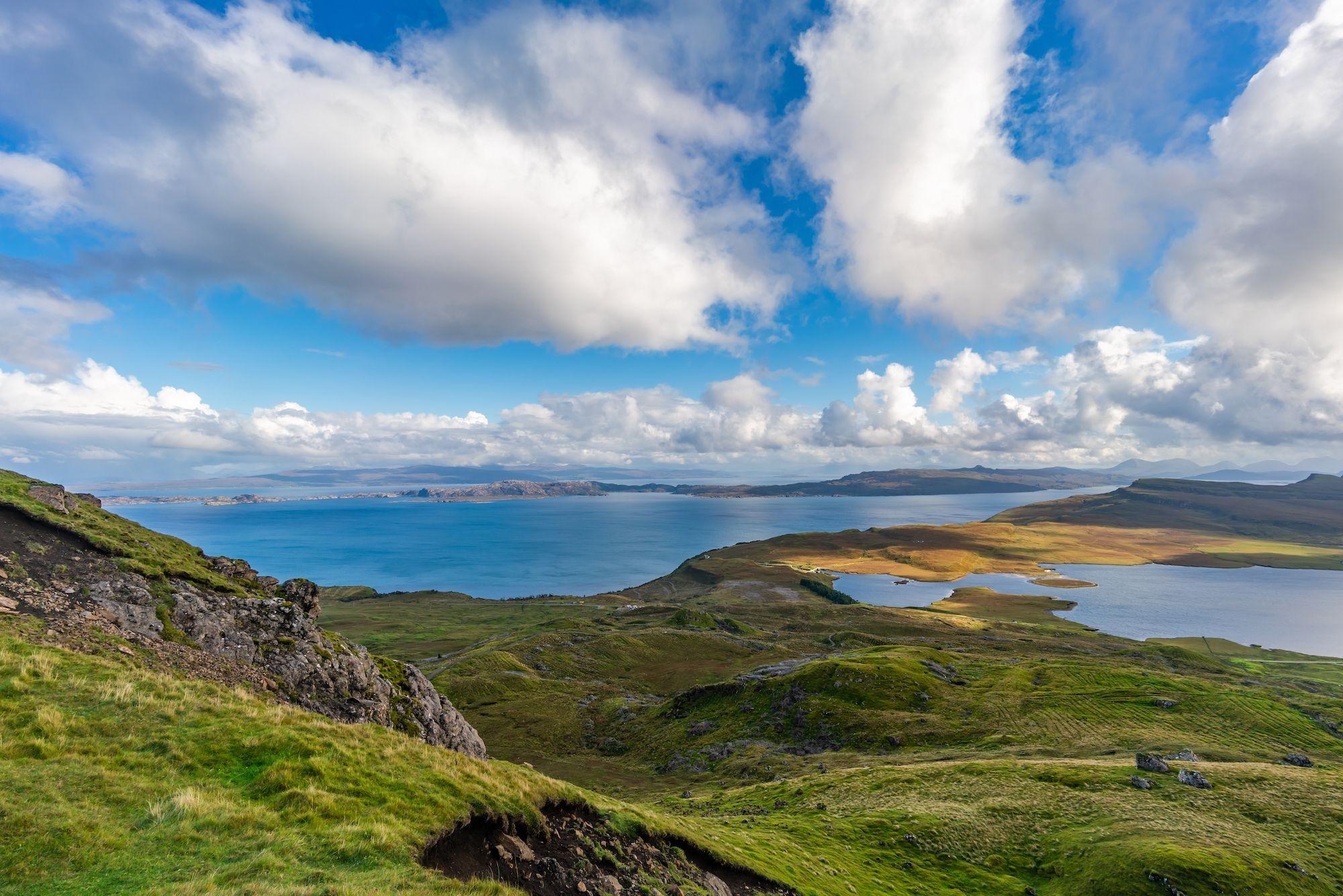
The landscapes of the Trotternish Peninsula ©Martin Fowler
Trotternish
The Trotternish Peninsula, north of Portree, has some of the most beautiful and unusual scenery on Skye. A loop road makes it possible to tour the peninsula by car from Portree via Uig, the village from which the ferry sails to the Outer Hebrides.
Quiraing
Staffin Bay is dominated by the basaltic escarpment of Quiraing, whose pinnacles and sometimes landslide slopes form one of Skye's unforgettable landscapes. It is reached by a 30-minute walk north from a car park located at the highest point of the minor road linking Staffin and Uig.
Old Man of Storr
The 50 m high basalt pinnacle called Old Man of Storr stands along the road 9.6 km north of Portree. You can walk to the base of the peak from the wooded car park at the northern end of Loch Leathan (about 3 km round trip). Seemingly impossible to climb, the pinnacle was instead successfully tackled in 1955 by English mountaineer Don Whillans, a feat equalled by very few others.
Fairy Glen
Immediately south of Uig, a minor road (signposted 'Sheader and Balnaknock') winds for about 1.5 km to Fairy Glen, an unusual and fascinating landscape of small conical hills, rock towers and ruined cottages, with a tiny lochan (small loch) along the way.
Skye Museum of Island Life
The distinctive smell of peat smoke, along with everything that evokes life in 18th and 19th century crofts, still lingers in the thatched cottages, historic croft houses, barns and farm implements of the Skye Museum of Island Life. Behind the museum is the Kilmuir Cemetery, where a tall Celtic cross marks the grave of Flora MacDonald; the cross was placed here in 1955 in place of the original one, of which 'every fragment has been taken away by tourists'.
The Sound of Raasay seen from the Old Man of Storr ©BBA Photography
Raasay
Raasay is a rugged, 16 km long island off the east coast of Skye. Its fascinating history is told in the book Calum's Road (2006) by Roger Hutchinson.
The island offers beautiful walking routes, including one that leads to a conical but flat hill at the top called Dun Caan (443 m); another leads to the ruins of the extraordinary Brochel Castle, perched on a pinnacle at the northern end of Raasay. The Forestry Commission publishes a free booklet (available from the ferry waiting room) in which recommended trails are listed. Accommodation on Raasay is very limited, so don't arrive without a reservation unless you intend to go camping (for which there is plenty of space in the areas to the east and north of the island).
Read also:
How to get to the Isle of Skye
By Car
The Isle of Skye has been permanently connected to the Scottish mainland since 1995, when the Skye Bridge was opened. The controversial toll for crossing the bridge was abolished in 2004, so crossing is free of charge.
The roads on the island are almost all single-lane; use the marked passing places to allow vehicles behind you to overtake.
By sea
Despite the bridge, a couple of ferries still connect Skye to the mainland. There are also ferries from Uig to the Outer Hebrides.
The CalMac ferry between Mallaig and Armadale is very busy at weekends and in July and August, so it is worth booking if you are travelling by car.
Glenelg-Skye Ferry has a small ferry (there is only room for 6 cars) that makes the short crossing from Kylerhea to Glenelg (5 min, every 20 min) every day from 10am to 6pm (until 7pm June and August).