While Italy's natural beauty is well documented, it is by setting off into the wild mountains and trekking along the dizzying coastline that you will realise just how beautiful our 'Bel' country really is.
Choose between moderate or strenuous hiking on the Corno Grande © Fab38 / Shutterstock
From the cliff-top paths of Amalfi to the gigantic granite spires of the Dolomites, volcano climbs in Sicily to rock-climbing in the heart of the flower-studded Apennines, Italy is the perfect walking boot. Here are seven of the best hikes, with information on how to tackle them.
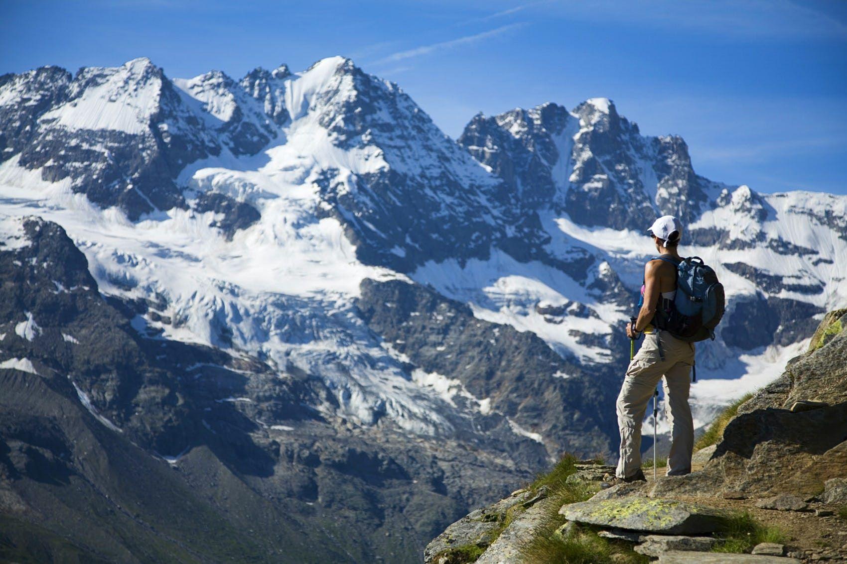
Spectacular views of the Gran Paradiso Alps from the Sella-Herbetet crossing © Andrew Peacock / Getty Images
Sella-Herbetet traverse, Gran Paradiso, Aosta Valley
Start/finish: Valnontey
Length: 20.5 km
Duration : 9 ½ - 10 hours
Difficulty: strenuous
The Gran Paradiso National Park in the Graian Alps is a natural spectacle of gem-coloured lakes, forests and some of the highest mountains in Italy, including the 4061m peak of the same name. This classic day trip takes you right into its heart. From the town bridge in Valnontey, the Alta Via 2 leads up an old mule track to the Rifugio Sella at 2588m, a former hunting lodge of King Victor Emmanuel II. Between the refuge and the Herbetet cottages, a forest ranger base to the south, hikers will find a short, airy traverse with a chain for protection.
The climb on the first day is 1180 metres and the journey is virtually downhill all the way back from the cottages to the village. The view of the valley is simply spectacular: sharp peaks, small glaciers flanking the eastern profile and the vast Tribolazioni Glacier below the Gran Paradiso itself. Herds of ibex and chamois graze peacefully on steep grass patches and you will see and hear marmots. Only venture out on a clear day: you must have a steady footing and a passion for heights.
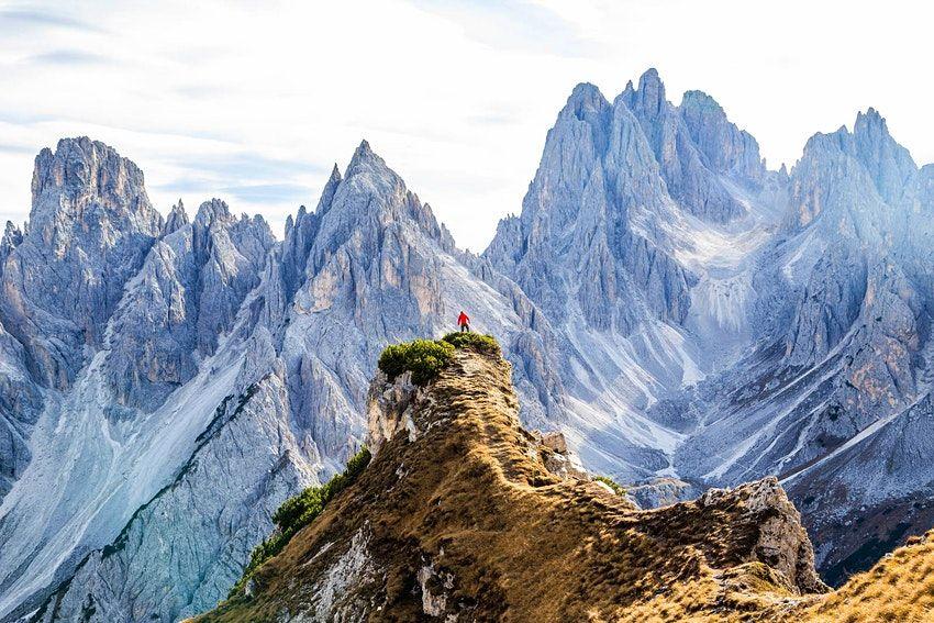
The Dolomites are truly breathtaking © Artur Debat / Getty Images
Tre Cime di Lavaredo, Dolomites
Start/Arrival: Auronzo mountain hut
Length: 9.5 km Duration: three to four hours
Difficulty: moderate
Mother Nature has been generous with Italy in terms of beauty, but she has outdone herself in the Dolomites. These cloud-scraping peaks and limestone towers jutting out over meadows, lakes and fir forests in the north-east of the country offer one of the most interesting walking spots in Europe. If you only do a one-day hike here, choose the Tre Cime di Lavaredo circuit in the Tre Cime Nature Park.
The trail meanders to the Lavaredo Hut, then ascends to Forcella di Lavaredo (2454 m) with unexpected views of the Three Peaks - a triptych of photogenic peaks in the shape of bishops' mitres, before heading to the Locatelli Hut and back to the Auronzo Hut (only bar and restaurant in 2020). Leave early to appreciate the trail at its best in silence (it can get crowded, especially during the summer months) and to avoid the afternoon thunderstorms. Access to the trail is via the motorway with a toll from Misurina (€ 30).
Subscribe to our newsletter! For you every week travel tips, special offers, stories from the world and 30% discount on your first order.
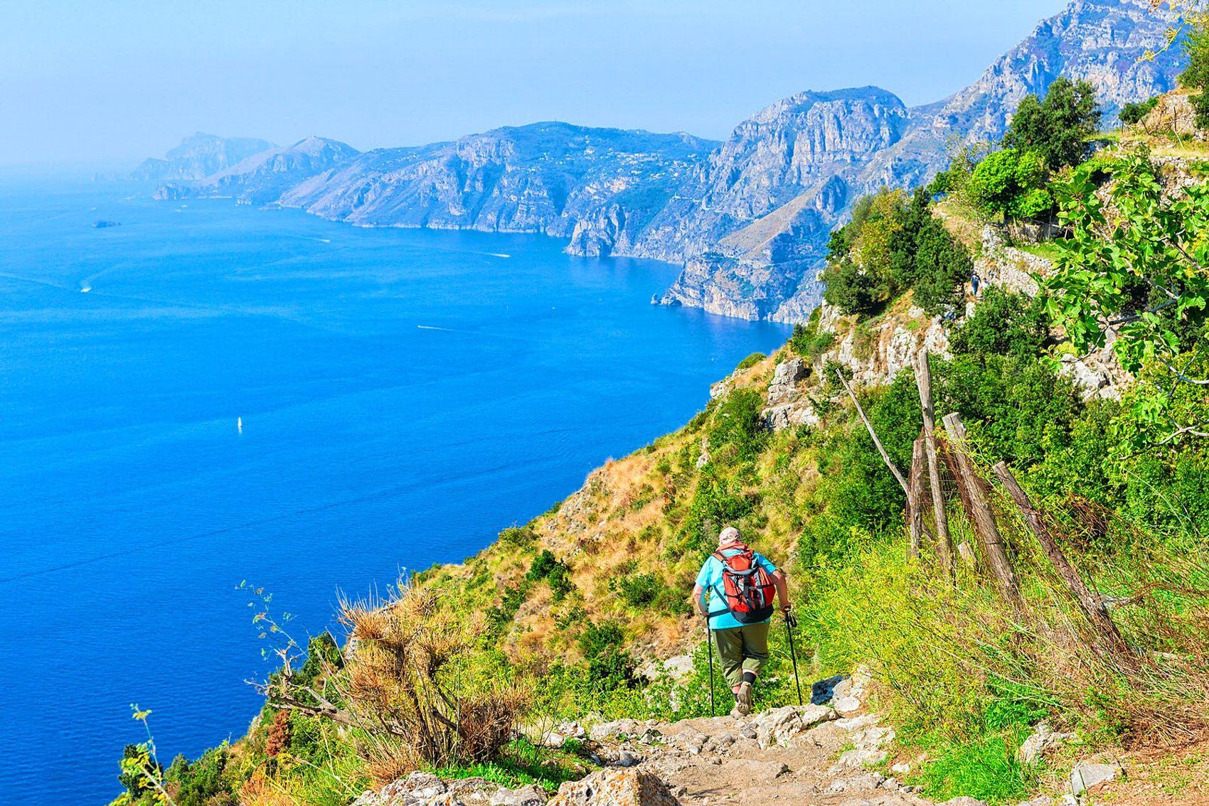
The Path of the Gods on the Amalfi Coast offers views as far as the island of Capri © Roman Babakin / Getty Images
Path of the Gods, Amalfi Coast
Departure: Positano Arrival: Praiano
Length: 8 km Duration: 4 ½ hours
Difficulty: easy-moderate
True to its name, the Sentiero degli Dei (Gods' Path ) offers a canvas of southern Italian landscapes, with extraordinary views of the rugged, densely wooded Lattari Mountains swooping down to the shimmering Mediterranean Sea and distant appearances of Capri.
Following an elevated, often rocky mule track from Positano to Praiano, the route opens up to some of the area's less developed countryside. You walk past terraced hillsides, lemon groves and scrub of rosemary and holm oaks. A flight of 1,500 steps descends to Arienzo, where you can stop for a refreshing dip. Pack a picnic and pick up a map of the walk at the local tourist office.
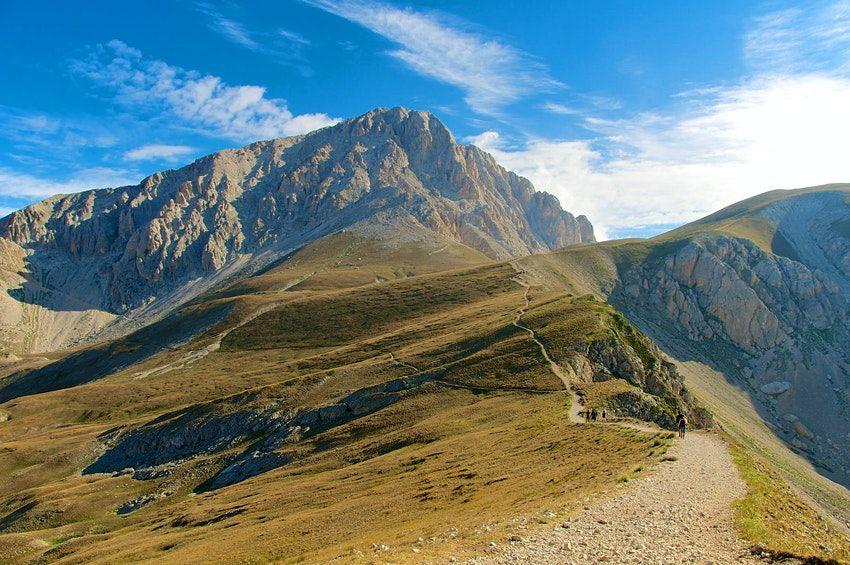
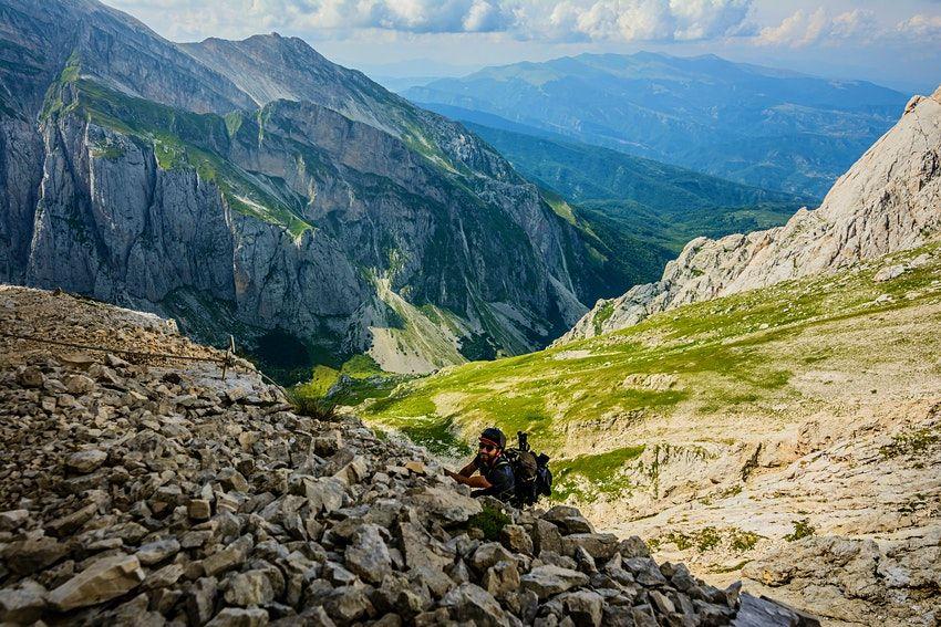
The road to the top of Corno Grande is surprisingly easy © Matteo Gabrieli / Shutterstock
Corno Grande, Abruzzo
Start/Arrival: Main car park at Campo Imperatore
Length: 9 km Duration: 5-7 hours
Difficulty: moderate (normal route), strenuous (direct route)
One of Italy's largest national parks, dominating the rocky landscape of the Gran Sasso National Park and Monti della Laga, Corno Grande is the highest peak in the Apennines. Take the normal route: a surprisingly easy climb along moraine streaked slopes to the summit with some easy rock climbing in the final section. The summit offers travellers wonderful views of the rippling mountain range and the Adriatic, a distant glow on the horizon as well as tantalizing views of Europe's southernmost glacier, the Calderone.
Experienced hikers can choose the alternative ascent that zigzags directly to the summit, a much more strenuous climb. In the quiet of the early morning or late afternoon, you may see an agile chamois or a golden eagle soaring through the sky. The best time for this excursion is from early June to late September when the mountains are snow-free.
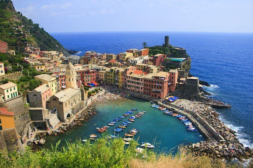
Vernazza is one of the beautiful villages that hikers encounter on the Sentiero Azzurro© WEKWEK / Getty Images
Blue Trail, Cinque Terre
Departure/arrival: check to see which sections are open
Duration: 3-4 hours
Difficulty: easy-moderate
Yes, the Cinque Terre really are as breathtaking as in the pictures. The five pastel-coloured fishing villages perched absurdly high look like they could fall off the cliffs at the first gust of wind. The Sentiero Azzurro (marked as No. 2 on the maps) once connected them, proceeding up and down alongside vineyards, olive groves and terraced hills, hugging the contours of the coastal cliffs along the sapphire-coloured Ligurian Sea but, due to landslides, some sections of the road are currently inaccessible.
The road is best travelled east to west from Riomaggiore to Monterosso but parts of the route are closed until at least 2021: be sure to check the official website before setting off. You will need to buy a Cinque Terre Card (€7.50 for one day), which will grant you access to the national park and use of the facilities.
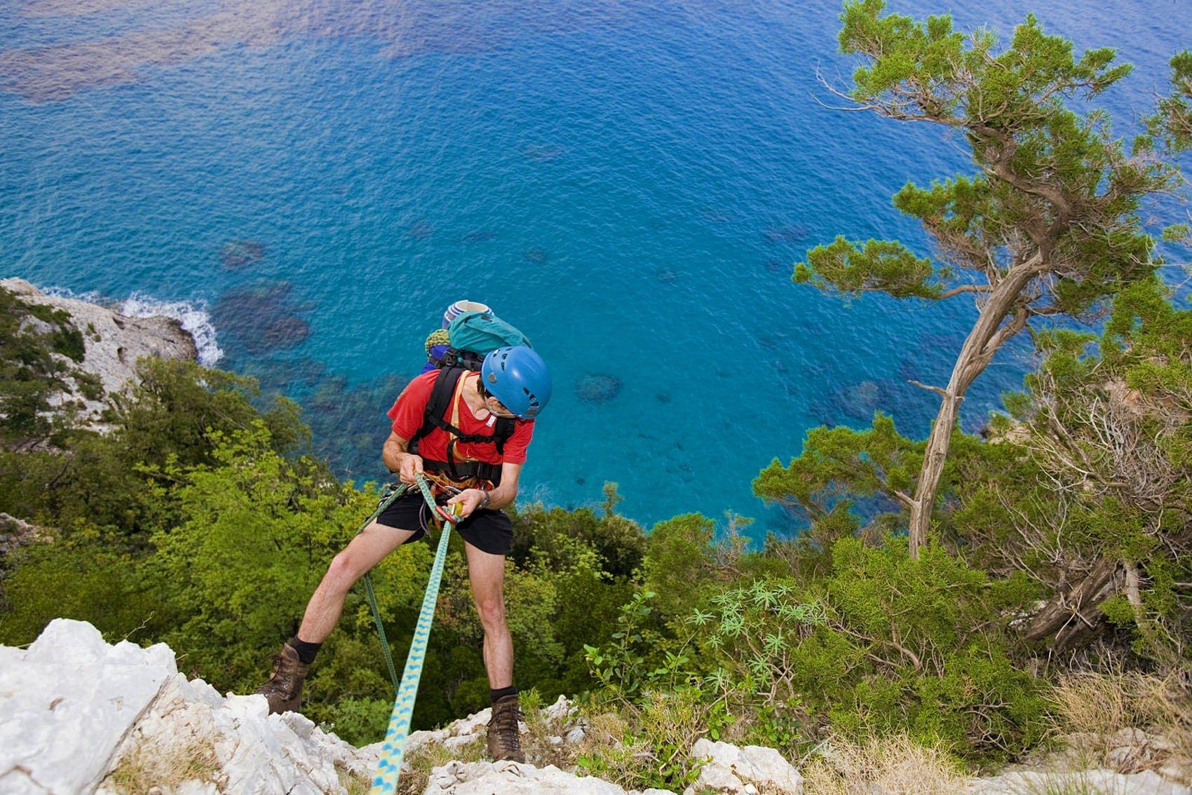
The epic Selvaggio Blu in Sardinia includes several spectacular rappels © Bernard van Dierendonck / Getty Images
Selvaggio Blu, Sardinia
Departure: Pedra Longa Arrival: Cala Fuili
Length: 45 km
Duration : 4-7 days
Difficulty : very strenuous
Often referred to as the most strenuous hike in Italy, the Selvaggio Blu is not for the faint-hearted. Making its way along the Gulf of Orosei on the east coast of Sardinia, this is an epic, off-the-radar hike that requires mountaineering experience. Water and signposts are sorely lacking, finding the path is difficult (even with GPS) and climbing it can be exhausting with rappels of over 45m and UIAA fourth-degree climbs.Nevertheless, it is well worth it. Multi-day hikes take you along one of Italy's wildest and most isolated coastlines with deep gorges, impenetrable vegetation, cliffs plunging 800m and unparalleled views of the Mediterranean. The paths of ancient shepherds and charcoal burners weave around silent bays and spectacular overhangs. Unless you know the area, however, you will need a guide.
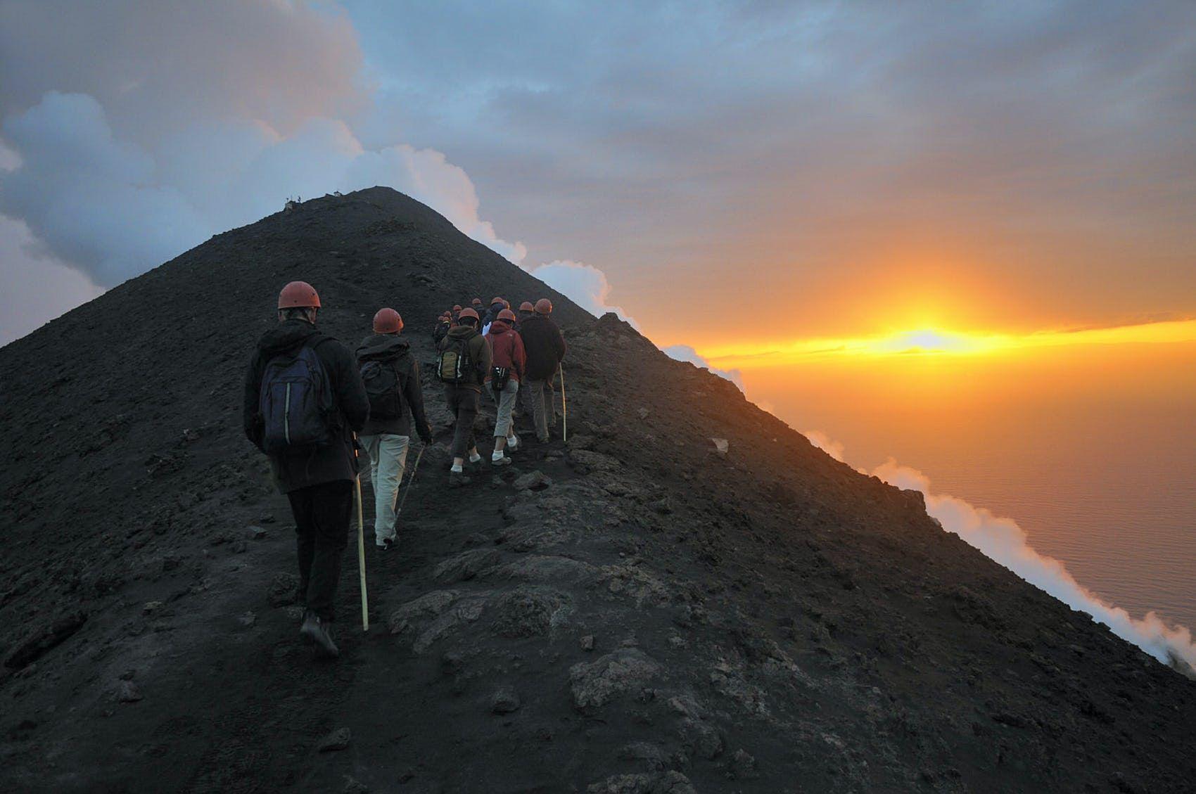
A sunset hike along the smoking cone of Stromboli © Sami Sarkis / Getty Images
Stromboli, Aeolian Islands, Sicily
Start/Arrival: town of Stromboli
Length: 7.8 km
Duration : 5-6 hours (round trip)
Difficulty: moderate-fatiguing
The walk up the perfectly pyramid-shaped volcano of Stromboli silhouetted against the cobalt-coloured sea certainly has a wow effect. It is not every day, after all, that one can walk on a steaming, always active cone. The most enchanting of the Aeolian islands, Stromboli is the scornful youngster of volcanoes, formed only 40,000 years ago. For nature lovers, climbing the crater is one of the must-do experiences in Sicily.
The hike is as varied as it is challenging, with wild capers and Sicilian broom along the way; it offers adventurous hikers wonderful views of the town of Stromboli as well as barren, elevated landscapes that contrast with the breathtaking seascapes.
Go at sunset to watch the crater fireworks at the 924m peak as day fades into night. Authorities regulate access strictly - you can walk freely up to 400m but you will need a guide (like Magmatrek's expert guides) to continue higher. It is also worth remembering that it is an active volcano - with a major eruption only in July 2019 - which means that this hike, however spectacular, has an additional risk.
Recommended guides and products:
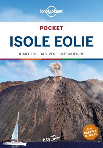
Travel guide
Aeolian Islands Pocket
Published in August 2020
Share this article
Looking for more ideas for travelling? Here are a few suggestions:
Here are the most recent articles in the category 'Outdoor adventures':
Related articles
Bubble Hotel in Italy: where to sleep in a transparent bubble under the stars

15 Things to eat in Palermo and where: street food, typical dishes and local recommendations
Hotel Le Bouquet, Cogne, Aosta, Italy
Hotel Savoy, Rome, Italy

What to eat in Rome and where: 11 typical dishes and best restaurants
What to see in Abruzzo: 20 places and things to do at least once
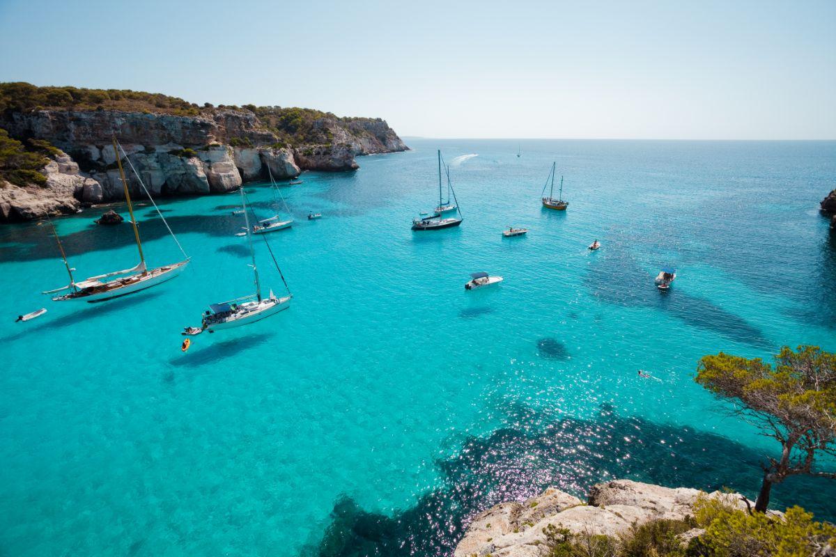
Menorca beach: top 21 best places to swim
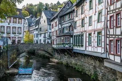
Pearls in NRW: These 10 small towns you must see